
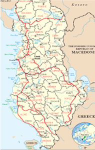
Albanian Map
Links
 |
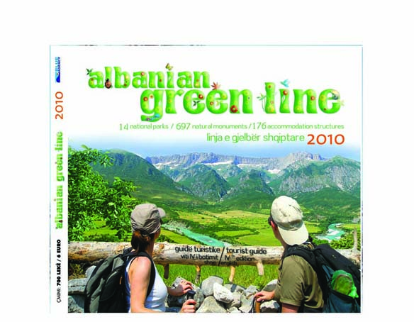
Publications
.jpg)

Dibra General Info
.jpg)
The county of Dibra is located in northeast Albania. Extends to the right of the Black Drin, west of Mount Deshati, on both sides of the brook to Bellova, in a soft hilly relief.
Archaeological findings in the territory of the city of Peshkopi testify for a civil life Illyrian, which dates back centuries III-II BC. It has a population of about 75000 inhabitants located at 1088 km2 mainly in settlements rural. All this about its composition has 1 municipality (Peshkopia) and 14 communes. Peshkopia is the administrative centre. The position of this district has played a very important part for the development of the area, which has been sometimes positive and sometimes negative, during the different periods of the history.
History
Peshkopia has been inhabited by the tribe of Penesteve Ilir. Peshkopi early residents lived in the hill called Gradishta of Peshkopi. This hill rises 698 m above sea level and stretches west Bugjenec village, north of Dobroves field and in the Southern spring of Bellova.
By mid-years from 527 to 560, Empire East, to be protected from the barbaric tribes, castles raised a huge military system in Hellade tuna. At this time a castle was established and today's Gradishten Peshkopi. In which official language at this time, the Eastern Empire was Greek, historishkruesi of Emperor Justinian, Prokopi of Caesarea, has translated castle – “Crown in Stefaniak”. "A new castle,, - has written authoritative researchers Croatian Shuflai Milan - Greek name, Stefaniakon, from which takes its name Peshkopia.
In 1020, Debar wins Episcopal status of a center, that sources with known Byzantine Name Episkopata Stefaniakes. Center first Episkopates that Portland has been bishop.
Despite the Episcopal chair of the Portland headquarters and changed twice more, she gave the name of Peshkopi city today, leaving Greek Name Stefaniakon annals of history.
In Ottoman Turkey in 1864 made a new administrative organization.
In 1913 the town of Peshkopi has seen a good commercial development. It counted 26 shops, some shoemakers, watchmakers, bakers etc.
Sulejman Delvina’s government decision Nr.424, dated 4 July 1920 that decreed the establishment of the prefecture located in Bishop Drin. On 15 April the Italian fascist troops invaded the town of Peshkopi. Residents have experienced a serious political situation, economic, psychological and social.On 29 July 1944 released by the city of Peshkopi nazifashiste invaders. From 1944 and until 1992 will prove Peshkopia was locality and from 1992 onwards the town is Town Hall.
Since 1920, when the administration first raised the following local Albanian town of Peshkopi has played as a center of administrative, educational, cultural, health, industrial district of Portland.
Geographic position
County District makes part in north-eastern region with a hilly relief, lies in the north-east of Albania on the eastern side of the valley of the Black Drin limited to the east by the Korabi and west by the mountain-chain. Center District (Peshkopia) extends 185 km from the capital and 21 km distance from the customs point of Bllata in Maqellara, from the east with the Republic of Kosovo and Macedonia with a border length of 90 km which is 19 km north with Kukes district bordering on 75 km west border line Mirdita and 13 km comes with Mat district on the border line, 60 km south on Bulqiza. The hilly relief gives to the area great possibilities to the development of tourism and economy.
Climate
The district does participate in the mountainous Mediterranean climatic zone and the Mediterranean pre-mountainous watershed. This climate is characterized by harsh climate, long and large precipitation of fresh snow and summer rainfall but the average temperature ranges from 6 sc in Mount Korabi in 11 sc at the valley. From April to September the average temperature is near the city 16?C. January is the month with the cold of the year where the average ranges from 0?C in-3?C. The quantity of rainfall ranges from 900 mm in a year.
This climate has a lot of favors after allowing development of some types of tourism, as well as several other sectors of the economy.
Transport
If you depart from Tirana, you can use the public transport. It is regular system of transport by buses or minibuses. The distance from Tirana is 185 km. The itinerary to follow is Tirana-Milot-Burrel-Bulqizë-Dibër. The ticket for the bus is 700 lek (5 euro) and for the minibus, 1000 lek (8 euro).
If you come from Durres, the itinerary to follow, is Durrës-Fushë Krujë-Milot-Burrel-Bulqizë-Dibër. The ticket has the same price as the itinerary from Tirana.
If you come from Macedonia you have to pass the custom of Bllata (Maqellara) which is 21 km far from Dibra. At the custom you have to present only the passport.
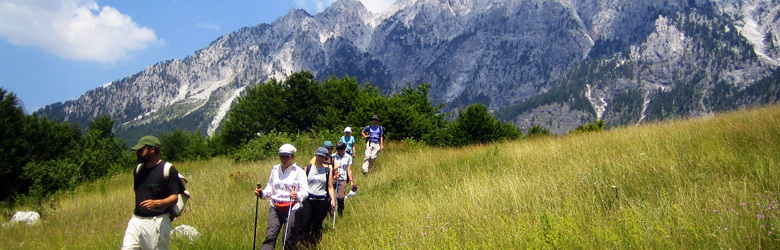
Tourism
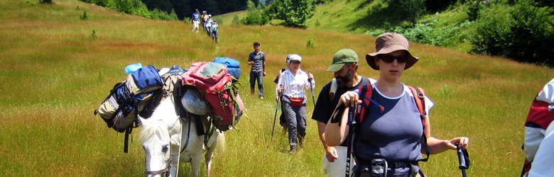
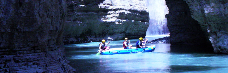
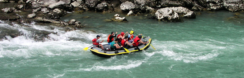
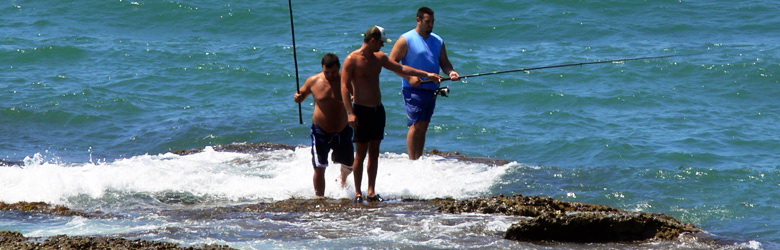
The most important kind of tourism is the mountain tourism, because of the hilly relief, and the big surface of forests. In the district of Dibra, lie two of the 13 national parks of Albania, Lura Park, and Zall Gjoçaj Park, which offer great possibilities to enjoy every detail of mountain tourism, winter and summer. You can climb, walk, ski, trek, do picnics, hunt, sail at lakes of Lura etc.
But at the other side, Dibra is an old household of tradition, hospitality, and inherits great values of humanity, history, ethnography, culture and other human values. It is very famous the hospitality of “Oda Dibrane”, a long-standing tradition, which make Dibra known allover Albania. From 1994 Dibra organizes the national festival of “Oda Dibrane” (the Dibra guest-room), which expands all the cultural, historical, ethnographic and human values of Dibra to hole Albania.
Another kind of tourism is the curative tourism. There are some sulfur baths in Dibra, which create the possibilities to develop the curative tourism for all the people who need this service for different healthy problems that come healed from sulfur waters.
Accommodation and gastronomy
Actually in Dibra are available different hotels, which offer very good service to the tourists. The old tourisn hotel is already now reconstructed and offers high modern standards of accommodation. Some of the hotels offer totally compelte service for the curative tourism.
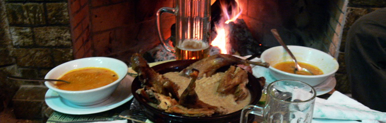
The area of Dibra is characterized from typical products of the zone, fresh and biologic, directly from the wonderful nature. The farming product compose the main menu of the gastronomy, also the vegetables are offered. But the international cuisine is offered too, to satisfy the customer requests. Two characteristic famous dishes in Dibra are “Jufka me oriz” (salty dish) and Sheqerpare Dibrane” (sweet).
What to visit
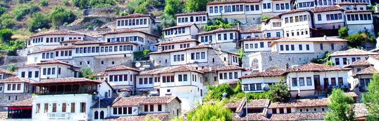
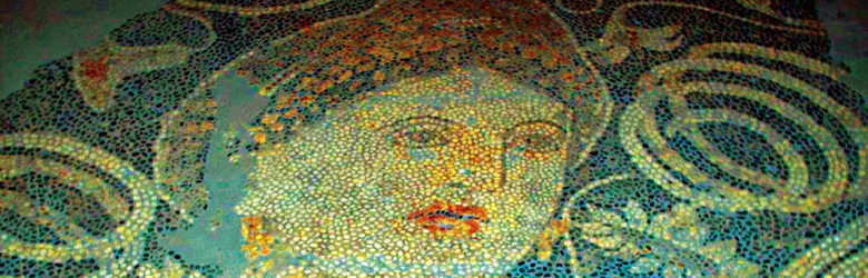
The museum, located beside the Ottoman style houses. It is situated in a characteristic dwelling house. It has housed an excellent collection of local costumes, carpets, kitchen equipment and filigree jewelry, as well as a number of models of local architecture. As of early 2008, the museum is no longer open.
Thermal Waters. They gush from the gypsum deposits of mount Korabi. There are two sulfatic springs with high contend of potassium . The waters treat several diseases (respiratory ways, diabetes, skin diseases etc) . There are private hotels in this area. Attracts tourists who look for therapeutic services and come from all over the world.
Lura National Park. Lura mountains climb up to a height of 1600-1700 meters with magnificent beech trees, and higher up, conifers. The highest point, a bare peak called Lura's Crown rises to 2112 meters.
The lakes of Lura which occupy glacial cirques at heights of between 1200-1500 meters or at best the four principal lakes, the Great Lake), Zi Black Lake, Lake of Flowers, and Lake of Cows.
National Park of “LURA”
Is situated on the region of Dibra, with a surface of 1.280 hectares, in the eastern side of the mountain massive of “ Kunora e Lures”. Its 14 icy lakes offer picturesque and attractive environments at an altitude of 1.350-1.720 m. Among the many lakes the one that stand out are the Big Lake 32 hectares, Lake of Pines 13 hectares, Black Lake 8 hectares and Lake of Flowers 4 hectares. In winter these lakes freeze. In the southern part of the park there is a meadow called “Field of Mares” which offers a relaxing view.
Climatic conditions
Fresh summer and cold snowy winter, which offer possibility to enjoy amazing panoramas during all the year.
Flora and Fauna
Its vegetation is miscellaneous with multi-color flowers and full of coniferous trees. This park offers various possibilities for developing eco-tourism, winter sports, equitation, horse riding etc. The park is the growing place of the brown bear, wolf, red fox, rabbit, eagle etc.
Sport and activities
Mostly you can walk among the wonderful nature, make excursions and exercise different sports as hunting during the season), climbing, trekking, riding horses etc. The camping is another pleasure but you have to be informed about the right places.
The natural monuments
Red Stone. Vakuf, 500m above sea level. Established in limestone rocks of Trias-jurasit, is 400 long, 2-3 wide, and 4 above, very rich in concretions. Peshkopi-Vakuf itinerary.
The cave of Rusi. Grykë Nokë village, 710 m above sea level. Established in the Trias-jurasi lime. Peshkopi-Selishtë Grykë Nokë itinerary.
The cave of the town. Bellovë, commune of Melan. Established in the permo-triasit Gypsum, it has not yet been explored. It is 10 m long, 2 m wide, and 3 m high.
The Cave of the Ice. Muhur, 1000 m above the sea level. Created in the limestones of permo-triasit. It is 50 long, 3 m wide, and 2 m high. Peshkopi-Bellovë-way to monument.
The Mirror of Grama. Sllovë, 1900 m above sea level. It shines because of the selenium presence. It is 500 m long, 200 wide. Peshkopi-Sllovë-way to the monument.
The Hole of the Fair. Radomire, 2115 m above sea level. Glacial-karstic cirque in schist, with length of 800, width 230 m, in the form of amphitheatre. Peshkopi-Radomire itinerary.
The Highland of the Ladies in Grama. Korab Mountain. 1700 m above sea level. Glacial cirques in schist, length 100-180 m wide in 1000, it has the form of natural balcony with alpine pastures. Peshkopi-Zimur- way to the monument.
The Gorge of Seta. Located in the deepest valley of Seta, formed in the Trias-jurasit lime, with a length of 1.5 km, 100-150 my deep, width 4-7 m. Peshkopi-Kukes itinerary.
The Mall Lura Gorge. 380 m above sea level. Established in the Trias-jurasit lime, 1.3 km long, 50 deep-width 5-6 m. Peshkopi-Fushë Lurë itinerary.
The Salt Rock of Kërçini. Sllovë, 1200 m above sea level. Gyps stone and salt rock, 900 m in length, 250 wide, and 200 m high. Peshkopi-Sllovë itinerary.
The Stone of Kërçinit. Kërçisht, 2000 m above sea level. Is a limestone of the upper Crete, about 12 ha, where are organized the pagan religious holidays. Peshkopi-Kërçisht road.
Tableland of Korabi. Radomire 1900 m above sea level. It is a glacial complex, 1000 m long and 200 m wide.Peshkopi-Radomire itinerary.
The Moraines of Lura Field, 1100 m above sea level. Represented by moraine deposits, 1.3 km long, 350 m wide, the cirques are coming from the Big Lake coated with beech and pine forests. Peshkopi-Fushë Lurë
The cirque of Lura's Crown, 1830 m above the sea level. Glacial magmatic rocks 900 m in length, 350 m wide. Peshkopi-Fushë Lurë itinerary
Money’s Hill (Bllicë) Kukaj village, 493 m above the sea level. The hill has a dome shape. According to the legend, here was the place of the hidden treasure. Peshkopi-Kukaj road.
The Field of Mares, Lura National Park, 1580 m above sea level. It constitutes in a glacial cirque. It was covered by the lake, that has been said. Its pastures are liked from the mares. Peshkopi-Fushë Lura or Rrëshen-Fushë Lura.
Hydro-monuments
The Lake of the Flowers. Covering about 45 hectares, it is a glacial cirque in the Lura National Park, 1600 m above sea level.
The Black Lake. Covering about 3 ha, it is a glacial lakein the Lura National Park, 1600 m above sea level. Peshkopi-Fushë Lura ititnerary.
The Black Lake. Covering about 3 ha, it is found in glacial cirque in Lura National Park, 1600 m above sea level. It is the deep, so there is black. Peshkopi-Fushë Lura ititnerary.
The Black Lake (Radomire). Covering about 0.8 hectares, located in Mount Korab 2200 m above sea level. It is a glacial lake. Peshkopi-Radomirë itinerary.
The waterfall of Pocesta in Maqellarë. In Mount Deshat, 1500 m above sea level. Water emerges at the level of 13m, through a slit along the limestone rock. Peshkopi-Maqellarë-way to the monument.
The Cold Water. Vleshë, 800 m above sea level. It appears in the contact between limestone and schist. With clean water creates attractive environment around. Peshkopi-Vleshë.
The Karst Source of Kërçini. 1670 m above sea level. It appears in the contact between limestone and terrigenous. The water is clean and creates attractive surrounding environment. Peshkopi-Kërçisht road.
The King’s Spring. Serakol, 1200 m above sea level. Appears in the contact between limestone and terrigenous. With clean water creates attractive environment. Peshkopi-Serakol itinerary.
The Source thermal waters in Peshkopi. The water’s temperature is 400 degrees C, dissolved salts and gases which cures the kurojnë rheumatism, arthritis etc. Peshkopi- Thermal waters itinerary.
The springs of Bellova. Commune of Melan. Karst springs, which come in contact between Gypsum and schist. Peshkopi-Bellovë road.
The source and cave of Sopanishta. Hydro-monument and geo-monument in the village of Çidhnë. Karst source, and cave, with 150 1/sek of flux, it comes in contact between limestone and terrigenous. The caves is unexplored. Peshkopi-Çidhnë rural road.
11.Bio-monuments
Krasta of Pocesti.