

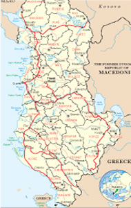
Albanian Map
Links
 |
Publications
.jpg)

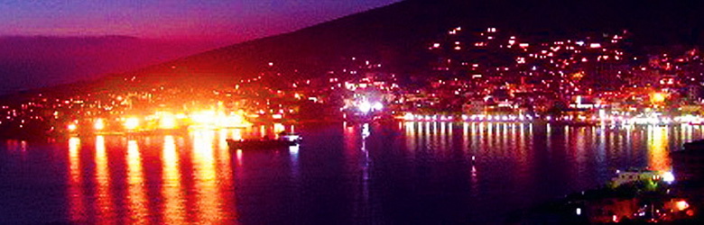
Bulqiza General Info
.jpg)
The locality of Bulqiza lies at the east side of Albania, and bounds at eastside with Big Dibra (Macedonia ), at north with Dibra (Albania), at west with Mati region and Tirana, while at south is bordered on with Librazhdi. The administrative center is Bulqiza with 16768 inhabitants. The locality has 1 municipality and 7 communes; Fushë-Bulqizë, Zerqan, Shupenzë, Gjoricë, Ostren, Trebisht and Martanesh. In this locality, lies also the town of Krasta with 5969 inhabitants. In Bulqiza and Krasta, is present the biggest sources of chromium. Together with 36 thousand hectares of forests of pine-trees and beech-trees, is composes the most important support for the economy of this area.
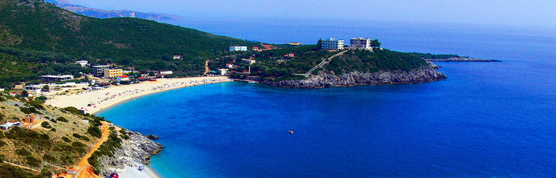
Bulqiza is one of the most important centers of the economy of Albania because of the big quantity of chromium, which is also today the resource of life for many families in the area. Unfortunately this zone is rich in sources but the level of life is very low. The future of this area, except the chromium sources, can be considered also the natural tourism.
History
The people of this region has always been a great example of resistance, against the enemy, Ottoman, Serbian, Italian and so on, because the valley of Bulqize is situated in a cross road, and is the main entrance to go to the inner side of Albania. It is very famous the Battle of Vajkali Plain, (April 1465), Gjorica (1844),e Xixulla (1860), the spring of Mure (1921) etc.
at the beginning of the Renaissance, the people of this region, has fight and win against the army of Hajredin Pasha. Noted courageous people contributed at the historic events the patriots of this region has been part of the annunciation of The Independence at 1912.
The people of Bulqize participated at 2nd World War against the Italian and German invaders where 68 heroes sacrificed their life.
The liberation found the country in a very deep poverty statement. The Comunist Party took every piece of dignity, exchanging the promises for the great freedom and prosperity, in a long wild dictatorship. The people of Bulqiza, remained very far away from his aspiration for the freedom, democracy and prosperity, which had characterized it during every époque.
At 1990, step by step, Bulqiza encouraged the creation of the private market and economy, the democratic forms of the live and again started to aspire the join of the European civilization.
Geographic position
Most of the relief is composed by mountains, which start from 420 m until 2101 m. In this territory lie the valley of Bulqiza 25 km long, 1 km wide. This valley is bordered on with Bualli Pass, 842 m high. Next to it, extends the national road which connects Burreli with Bulqiza, Peshkopia and Big Dibra through the valley runs the gravel spring of Bulqiza which streams at Black Drini river.
Climate
The climate all around Bulqiza is continental, cold in winter and dry in summer. The valley of is open from the eastside and so, very wheather-beaten. The medium degrees goes to 10°C and the maximum until 35°C in summer. During winter the lowest degree is –18°C. the quantity of precipitation is 980 mm.
The battle of Vajkali
This village has a long history and is mentioned also at the work of Marin barleti “The story of Albania”. According to Barleti, Vajkali is the place where at the spring of 1465 the national hero Scanderbeg has fight against the Turkish Army. Even the writer of Renaissance
Gavrill Dara, has written about this battle. At the side of the field of Vajkali there are some stones called “The stones of Scanderbeg”. This term is known for all goers of Dibra.
The origin of Bulqiza
The town of Bulqiza was constructed at 1948, because of the chromium mine and today counts 15200 inhabitants. The field of Vajkali penetrated by muck, has been a big bog, surrounded completely by dense pine-trees, beech-trees and oak-trees forests. The first inhabitants came from the villages Koçe abd Dushe, built houses by stone and muck, with wood roofs, mos of their composed by two stairs, down for the animals an up for the people. The clothes and the covers was composed by leather, wools and animal skins.
At 1954 was built the electric central station. Which furnished the mine with energetic power. At 1957 the power passed to the village of Vajkali too. At 1968 was built the substation os energetic power, of 110 kilovolt. Now this substation furnishes Bulqiza and all the area around it.
The chromium, national richness
The discover of the chromium at the territory of Bulqiza was made casually during the Italian invasion at years ’40 while the utilization of the mine started few years after the liberation. At the beginning of 1940, Hamit Duriçi, an inhabitant of Vajkali village, while was punching, found a black stone with a metallic brightness, heavier than the other stones. He handed it over the Italian officers which worked at that area. The Italians started to collect the chromium on the surface of the field, and transported it by mules until the road which has started to be built at those times. In 18 February 1948 a group of specialists came from the mine of Rubiku, together with some boys of Vajkali, started the work for the production of the chromium. During the geologic researches, discovered chromium reserves, which warrantee the work of the mine for 25 years. At 1972 in Vajkal finished the factory of the elaboration and enrichment of chromium. Until now has been extracted from the mine 2 million tones concentration of chromium. Totally in this mine has been extracted 2.6 million tones of chromium, has been open 600 km galleries, have worked at different times 7200 workmen, technicians engineers, and today the process of the work develops at the pits of 100 m under the sea level. 289 people have immolated their life doing their work. 12 of this people was from Vajkali.
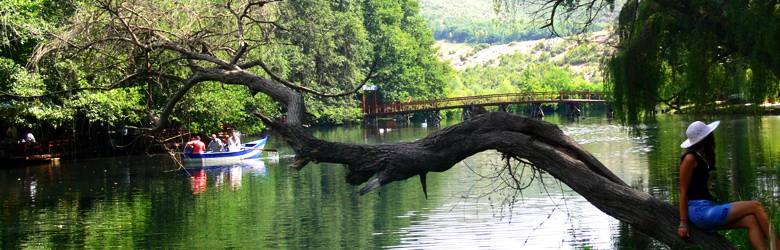
The natural monuments
The cave of City Bridge. Valikardhë, 650 m above sea level. It is composed of limestone of Trias-jurasi. The known part reaches 30 m length, 15 m wide and 30 m height. There are concretions of a rare beauty. Bulqizë-Zerqan itinerary.
The Shutrea Cave. Near the village of Vali, 900 m above sea level. It is karst cave with a length of 800 m. There are two entries, one in the form of the well, about 100 m deep, the other is a cavity, about 30 m above the bed of the stream of Peshku. Then continues horizontally and terminates in the lake. U eksplorua part by Italian speleologët Frankës Martina and P. Qiriazi of K. Priest. There geomorphological teaching values, tourist. Tirana-examined the way Dajt-awl-Val-pedestrian street to stream fish.
Vali Cave. Situated near the village of Val. Karst cave is at the junction of tectonic breaking into limestone. It is 250 m long, 30-35 m wide and 25 m high In her entry of Bizet enter and exit stream in the valley of the Mat, which is another uncharted cave, which is related to that of Vali. There geomorphological teaching values, tourist. Tirana-examined the way Dajt-awl-Val.
The rock of the City. 700 m above the sea level, magmatic rock, in a pyramid shape. Bulqiza-monument itinerary.
Xixëll Martanesh. Peshk, 1200 m above sea level. It has an oval shape, about 5.1 m long, several hundred meters wide. In the midst of it are: keeping a fir, a karstic source, and a memorial for battle of Feze Bulqiza clerical and a bridge of Qerbela. The pass of Buallit-Peshk itinerary.
The Cold Cave,Gjuras 920 m above the sea level. Limestone karst cave of Trias-jurasi, 25 m long, 2 m wide, and 2 m high. It has a lot of concretions. Gjuras Bulqizë itinerary.
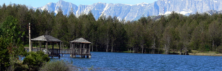
Hydro-monuments
Three taps of Zerqani. Sofraçan Krajkë, 700 m above sea level. Is named also as the Pond of Priest. There are some karst springs, which come in contact with the Trias-jurasit limestone with terrigenous. Creates an attractive and restful environment. Bulqizë-Krajkë-Sofraçan itinerary.
The source and cave of Zerqani. 900 m above sea level. It is composed of Trias-jurasit limestone, and terrigenous. Bulqizë-Zerqan itinerary.
The Black Lake, Martanesh. 1800 m above sea level. Glacial lake, about 45 ha, located in a complex of cirques, 400 m long, 200 m wide, 60 m deep. Characterized by crystal clear water, cool and of rare beauty. The Black color associates with the depth and deposits kromites inside. Bualli pass- Batër Martanesh- Lake itinerary.
The waterfall of Duriçit. The Water comes from Black Lake. With a height of 20 m, creates wonderful spots. Bulqizë-monuent itinerary.
Bio-monuments
The coast of Pepe or the Oak of Pepe