
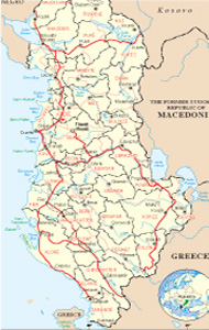
Albanian Map
Links
 |
Publications
.jpg)


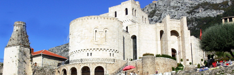
Gramshi General Info
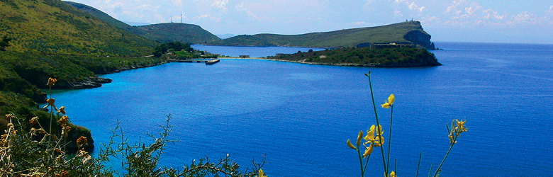
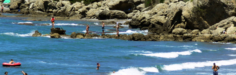
Gramsh is a small town in southeastern Albania. Connected with Elbasan, Korça, Pogradec, Skrapar, Librazhd and Berat, it crossed by the river Devoll linked to the road to Elbasan, lies in its most along the river and valley Devoll. We should not forget that the town of Gramsh gives a beautiful view of the mount Tomori. The cold water that comes from this mountain is a miracle that you can not find in another city. Gramshi is also known for its cheese in the area of Grabova and Lenie. Also it is a city with wonderful landscapes, lakes, waterfalls, which above all are untouched by human hand and where you can enjoy the nature by real, in quietness. Gramsh district is quite rich in natural monuments, some of which are protected by the state.
Relief and Climate
Gramsh district environment in terms of relief is hilly, mountainous. The Lowlands are missing because there is no palm land under 100 m above sea level. The entire territory lies at an altitude of 119-2373 m. Within the climate of Albania, the territory of the district has average Mediterranean climate. Features of the climate is cold and wet winters and hot and dry summers
History
Documentary searches, place names, legends, etc., indicate that Gramsh has been inhabited since ancient times. This is confirmed by archaeological findings in Tumulus (Lair Hill) of Cëruja, and an interesting finding, part of the inventory of a tomb in the foundation of a building on the hospital in the city, which dates from around the XI-XII century BC. The site on which the city is today, has been the center of the village of Gramsh. He is remembered by this name in the fifteenth century. Traditions indicate that after being burned by the Turks, it was built near the mountain of Vines, where today is located Gramsh Village. This center, though moved, continued to be inhabited. The reason was the position, the existence of water and fertile lands that were on Devolli’s river edge. In this country, where is the town of Gramsh, has passed a branch of the ancient Road Egnatia, in the Illyrian (II century BC). In the Middle Ages, the area was under the possession of Prince George Arianiti. In beginning of twentieth century, the center of the village Gramsh roof was put back on the Devoll where today is located the city. From 1912 until 1947 was the center of Gramsh area. With the new administrative division, it became the center of Gramsh district, in which were placed various state institutions. Gramsh was declared city on February 18, 1960. Since 1992 onwards is labeled municipalities. In the city, today are placed the local and central institutions, such as the head offices of the Municipality, of Gramsh, educational, cultural, health, institutions, etc..
Culture and ethnography
The people of Gramsh have cultural ancient traditions. In the eighteenth century in the village of Upper Grabova a major contribution to the painting have given Çetiri brothers. They are followers of the painters Korça Zografi and filled with frescoes and icons over 11 had known of the country. Besides the development of education, after the liberation of the country began to expand even the cultural life. In 1951 the cinema was opened in the town of Gramsh and artistic groups, theater, folklore, etc., started to grow. The artistic groups in the country raised in institutions and have performed in cities, villages and outside the district. Also a big library was set up in the district, which is now located near the Palace of Culture with 39 thousand volumes of 11 thousand titles. In recent years efforts are underway to create folk groups such as Ensemble "Miqesia" who started to give concerts with folk theme in the city and district municipalities. In recent years a big development are taking the literary publications.
The Traditions of the area and the clothes of Gramsh, resemble more Devolli area characteristic than the area of Elbasan, in whose district it is. Women's clothing coats consisting of long shirts, while men use the kilts, the garment with pens, characteristic of central Albania.
What to visit
In the district of Gramsh are situated 16 cultural monuments protected by the state. Such are: the Illyrian city of Kodrinonit, Irmanji castle in the municipality of Tunjës, Tërvolit castle, the Bërsnikut Gradishta, Prrenjas castle, Galigatit castle, the castle of Lower Grabova. Evidence of the ancient people of Gramsh are the tumulus, that are found in the territory of Cëruja, commune of Pishaj.
The two stone bridges and the Church of St. Nicholas in the Village of Upper Grabova in Lenie.
The Stone fountain near the Shëmbërdhenji’s Tekke.
The fortification built in XVIII century of Prrenjas village.
Prrenjas-Tunjë paving of the XVIII century, near the Village of Gramsh, Pishaj and many other causeways. Besides these cultural objects, declared cultural monuments under state protection, are also 16 other objects of historical and cultural profile, such as the Castle of Gjera and Kabashi, Ballolli Castle, Broshtani Castle, Vidhani castle, etc. .
Gramsh district is rich in monuments of nature also, some of which are protected by the state. Below we mention a few:
Kabashi Cave, located at height 800 m above the sea level, on the right side of the river Holta, 200 m on the southeast of the castle of Kabashi. Inside there are ramifications and underground labyrinths.
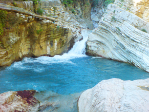
Devolli Canyon, starts hanging bridge near the village of Korca, Zerec and ends at the bridge of Bletëza, in Gramsh. In this length of 12 km, river rocks Devolli slot between the mountains of Sogora and Koshnica. In the bridge of Grabova, the canyon of Devolli joins the gorge of Grabova.
The Source of Kërpica, is a monument of great economic value and is located 700 m in the southwest of the village Kërpicë, 390 m above sea level. In it, is built the aqueduct that supplies Gramsh and the villages of the area from where the pipelines pass.
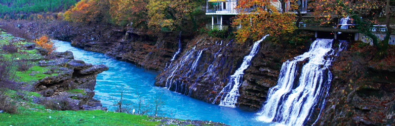
Waterfall and cataract of Sotira, located in the northeast slope of Mount Tomorr. Waterfall waters come from two main channels of cracks. The height of the fall of the water varies from 5 to 20 m. We may also mention thermal springs of Kërpica, Holta, the source of cold Black Lake in Lenie, Devolli river terraces, "the frozen marriage people" in Mount Liseci, etc.
Grabova
Grabova and the surrounding environments is a miracle of nature. Its values increase from the mineral resources that are in its vicinity. The climate of good weather, beautiful nature and calmness, create a positive impact on improving the overall situation, of nervous system, creating emotions that impact positively in improving the appetite, metabolism etc.. The curative waters of Grabova have considerable natural values. The water with his physical qualities is naturally used in different ways to cure diseases and wellness of the body. The curative effect of water becomes greater when you are melting the various chemical elements. They have in their composition and chemical elements micro-elements in sufficient quantities to perform the treatment effect on human organism. One such a source is not far Grabova. The Cold Water or Black Lake, which the effect of color is a result of mineral compositions on it, is known in a wide range for its curative value. Although there have not been made scientific analysis by specialists in this field, the people with their experience has been put into use this miracle water.
The natural monuments
The canyon of Sineci, Sarasel. Sult. Formed in limestone of Crete by the erosion of karsti and the stream of Saraselit (Katundasit). It is about 2 km long, 200 m deep and 20-30 m wide. On the slopes there are unexplored caves and between them, also the Katundasi inhabited caves. Lapardha-Lumas-Përrenjas itinerary.
The rock (canyon) of Kopaçi. Grabova, 1250 m above sea level. It is formed in limestone of Crete by the erosion of karsti and the stream of Grabov, Devolli branch. It is about 1.5 km long, 300 m deep and 20 m wide Gramsh-Lenie-Grabova.
The canyon of Holta. Kabash, Bardhaj. It is formed by the erosion of the stream of Holta and karst. It expands and closes, reaching enormous depth, about 3 km long, and 10 m wide. On the slopes there are unexplored caves. Gramsh-Holtë road.
The Terrace of Ballore. Located on the peak of Devoll, near the village. It is a river terrace, formed by the Tomorica and Devolli, 800 m long and 200 m wide, and 15 m high. It contains prehistoric remains of dwellings Gramsh-Skënderbegas.
The Stones of wedding-people Lisec. Lime stones of special shape, created by karst and wind. The legend connects them to "freeze people” that are going to a wedding. Gramsh-Lisec itinerary.
The Karst of Tërvoli. Amazing landscape, characterized by many forms of surface karst Gramsh-Tërvol.
Kabashi cave. About 200 m in the southeast of the Kukël mount, 900 m above sea level. Established by karsti cliffs in the limestone of Crete, about 100 m long, rich in stalagmites and stalactites with a rare beauty. Gramsh-Kabash itinerary.
Hydro-monuments
The lakes of Valamara. Lenie, about 2200 above the sea level. There are three glacial lakes in Valamara cirques. Separated by three moraines. The largest is 600 m long and 200 m wide, and about 3 ha of surface Gramsh-Lenie-Valamara Mount.
The sources of of Kërpica. In the bottom of the stream of Belica (Tomorica branch), in the contact between limestone and flysch. There are hot mineral resources containing sulphide gas. The flux is is small, and colored of yellow, because the of sulfur containing and smells as broken eggs. Mixed with black mud. Gramsh-Kërpicë ititnerary.
The waterfall of Sotira. northeast of Tomorit, Big source which comes out from the longitudinal cracks in the craggy limestone rock. It has over 5 m of length, height to 20 m. The Landscape of the slope where the water comes out, creates a magnificent spot, among the forest of oak trees. It can be heard quite away. Gramsh-Sotirë-monument itinerary.
The lake of Dushku, Lenie. 1105 m above sea level. It is located in the glacial trough, 1.4 km long and 400 m wide, while the surface is 22 ha. Constitutes in a lake’s ecosystem with rich biodiversity, especially the lotus. Gramsh-Dushku’s Lake.
The Black Lake. Lenie. 4 km from the village, in the pass of Mushka, 1634 m above the sea level. Glacial lake with a surface of three hectares, 1000-1200 m long and 2000-3000 m wide Surrounded by a forest of beech and elm-tree, 25-30 m high, diameter of 20-35 cm 100 years of age Gramsh-Lenie-Black Lake.
Bio-monuments
The elm-tree of Valamarë.