
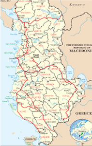
Albanian Map
Links
 |
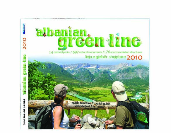
Publications
.jpg)

Saranda General Info
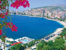
We are already in the most southern corner of Albania, there where is hidden among the hills and washed from the blue waters of the Ionian Sea, one of the most beautiful seaside towns. We are talking about Saranda, as a pearl of the Albanian Riviera.
The town has always served as port for the Mediterranean countries, but has been not so important as a trade centre, because, another town was important during the ancient times. This town was Buthtrotus.
Saranda, the small town that can be called “The getaway to the Southern Albania” is situated between high mountains and the blue Ionian Sea. Built on the Ionian seashore, facing the greek island of Corfu, Saranda injoyes a typical mediterranean cilmate, wich is gentle and characterized by optimal seawater temperature. The favorable geografic position and climate, make Saranda one of the most appealing touristic destination in Albania and not only for these reasons but also for its historic and archeologic values.
History
In antiquity the city was known by the ancient Greek name of Onchesmos (or Anchiasmos) and was inhabited by the Greek tribe of the Chaonians. Onchesmos flourished as the port of the Chaonian capital of Phoenice (modern-day Finiq). In 552 CE it experienced repeated attacks from the Goths. Its current name comes from the name of the Byzantine monastery of the (Agioi Saranta) literally meaning "Forty Saints" in Greek, after the Forty Martyrs of Sebaste, traditionally commemorated by the Orthodox Church on 10 March. The town was included under the newly formed Albanian state in 1913, under the terms of the Protocol of Florence. It was occupied twice by Greece in 1913 and 1914-1916, by Greek insurgents of the Autonomous Republic of Northern Epirus in 1914 and by Italy between 1916 and 1920. Saranda was again occupied in 1939 by Italian forces and was a strategic port for the fascist forces of Italy. It was then temporarily called "Porto Edda" in honor of Edda Mussolini, the eldest daughter of Benito Mussolini, during which time Albania was annexed to Italy. In the meantime, it was also known by the Italian name Santi Quaranta (Forty Saints). During the Greco-Italian War the Greek army occupied a large area of southern Albania (called "Northern Epirus" by the Greeks) and the city came under Greek rule on 6 December 1940 until the German invasion in Greece and the consequent withdrawal of the Greek army in the spring of 1941.
Tourist values
Saranda is well-known for the world because has been so even during the comunist regime. After ’90, Saranda has been exchanged in a veri tourist city, which expects more than 1 000 000 people during the summer season. A large net of accommodating and gastronomic structure, offers the best for the tourists.
Saranda is the destination of foreign visitors not only for her blue deep waters of the Ionian sea, which offers amazing bays in different tourist villages, but even for the cultural and historic values, which are represented mostly from ancient city of Buthrotus, (UNESCO member), Foinike, the monastery and different churches of Byzantine periods, etc., the natural attractive points as Ksamili, Blue Eye, Kakome etc,.
What to visit
Travelling south from Saranda, along a panoramic road by the rocky shores and marshland, you reach the archeological sity of Butrint, the most important in Albania, protected by UNESCO. The antique city of Butrint was first inhabitated by the Illyrians. Its name derives from the bull (gr. Buthrotos) that the troyan prince, Enea, sacrificed here, on his way to the Temple of Dodona to assure safe passage.
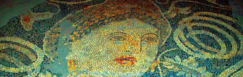
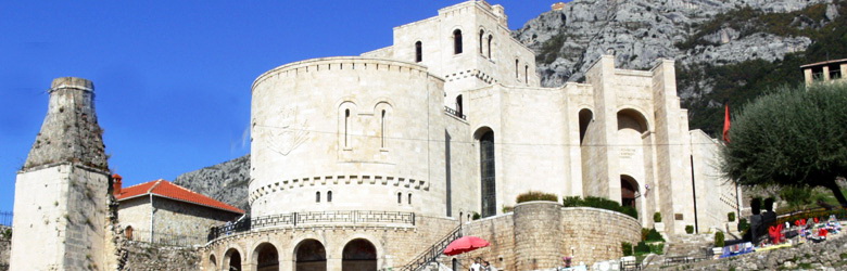
The most significant archeological objects are the amphitheatre of Buthrotus, where since sixt years is the place of the International Festival of the Theatre, organized from albanian artists, the temple of Aesculapius, the altar of baptims, mosaics, thermal baths, walls and antique entrance to the city. There is also the medieval castle of Ali Pasha, thas houses the Museum of Buthrotus. From the castle, you can see the landscape, one of the mos untouched and antique of the whole Mediterranean.
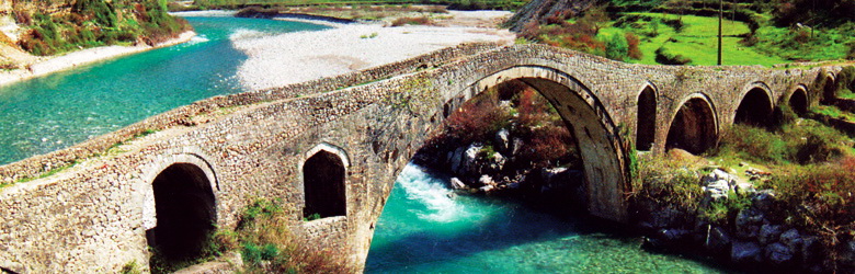
Another historical monument is the medieval castle of Lëkurës, erected on a hilltop, only 2 km from Saranda. Is was built in the 15th century, during the campain of Sulejman Pasha against the Corfu.
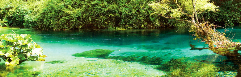
During your stay in Saranda you can visit also the spring of the “Azure Eye”, 18 km to the northeast of the town. The contrast of the blue waters, the vegetation, the shadows of the century-old oak trees, make this destination even more relaxing.
Ksamili is a village along the road to Butrint, with hiden azure bays like in the legends and there is a very nice destination to spend your day. Small islands in this area are full of restaurants with fresh seafood and you can taste the dishes in the midle of the blue waves.
If you sail along the seashore of Saranda, you will find the marvellous villages of Lukova, Borshi, Krorezi, where the smerald nuances of the water in the seashore, meet the deep blue of the far away. The panorama will stay in your mind as one of the most beautiful things you have seen in your life. It seems as the image of the paradise.
Accommodation
Luxurious hotels are built lastly in Saranda because of the growing number of the visitors. There are almost 1 million people to chose Saranda as their destination for holidays. But Saranda is visited during all year from the foreigners.
Gastronomy
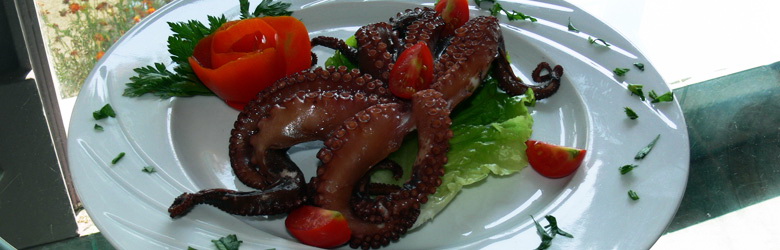
Saranda offers to you every thing starting with the seafood cuisine but is famous for its mussels of the Buthrotus Lake. You can find it in every restaurant of every category, or even in the open market in order to cook it according to your preferences.
Entertainment
Every detail which makes your vacation joyful is present in Saranda. If you make a short trip every day in the places around the town through the historic, natural and cultural zones, you will live unforgettable experiences.
About the night life, in Saranda you may go to a lot of discos as Mango Beach, Tropical, Keljani ect.
Don’t lose the chance to see Saranda, as the last pearl of the long chain of the Albanian Riviera!
The area of Saranda has a diversified relief, which starts from zero quotas up to 1833 m altitude. The average height of Saranda city is about 100 m. The relief is flat and hilly. Crowns of the surrounding mountains from the north, east and south, giving the appearance of a closed basin. Inside lie the fileds of Vurgu, Vrina and Delvina areas. The virgin coast reserves a prosperous future tourism throughout the province of Saranda. Saranda district lies on the warm areas of Albania, where the prevailing climate is Mediterranean . The annual average is 16-17 degrees C, while the average of the coldest month, 10-12 degrees C. Butrinti lake has an area of 16.3 km2, a length of 7.1 km, while its width starts with 150 going up to 3200 m. There is a depth of 21.4 m. With the exception of its northern area, it is surrounded by hills, sites which fall as a knife's on the lake.
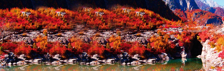
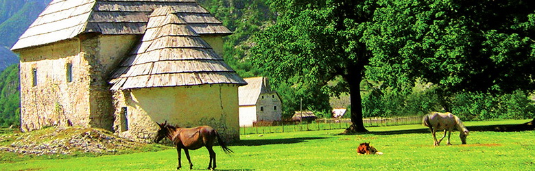
Borshi valley is one of the richest forest in southwestern Albania. It's wearing green stains, of Mediterranean vegetation, is characterized by oak-trees, plane and willow, also by bush-plants. It is 15 km long, with a width that runs from 640 m to 2500 m. Borshi Valley opens like a fan, leaving the place for the white coast of fine sand of Shalla. The end of this valley is the most coveted coastline for beach. In the district of Saranda pastures and meadows occupy 48 000 ha of land.
Tourism and nature
National Park of Butrint (Buthrotus)
Is situated nearly 25 km in south of the city of Saranda. Its scientific, tourists and health recovering values combine with a bio-diversity of national and international importance. Its surface is about 8591 hectares and is the most organized national Park in Albania.The area “Channel of Cuka-Gulf and Island of Ksamil” offer relax and recreation. Its islands form a real oasis for the wonderful coastal and terrestrial landscape.
They are covered with typical Mediterranean vegetation. Suchlike is the wood near
the ancient city of Butrint, which consists of a real subtropical jungle, where high
trees and laurels are dominant. It’s an area of significant importance for the tourism
in the country. First for the cultural tourism with the ancient city of Butrint that is under
the protection of UNESCO, blue tourism in Ksamil, echo-tourism in Lake of Butrint,
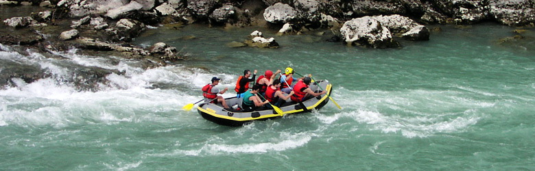
aquatic sports also in Lake of Butrint , fishing, etc.
Climatic conditions
The park has typical Mediterranean climate, with dry hot summer and wet soft winter, with a lot of rainfall during the spring and the autumn. The temperatures during the summer go to the 40 grade Celsius and during the winter some grade up of zero.
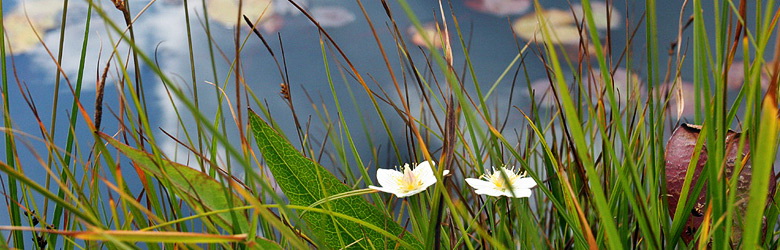
Flora and Fauna
Under the marine water we have a rich flora and fauna. We mention Halophyla stipulacea and Pinna nobilis, protected species from the convents where Albania is member of. The lake of Butrinti is important for ictiofauna/waterculture and its avifauna, included the lake of Rrëza, witch is connected in the east side. Inside of the zone there are some separated groups of trees, typical of Mediterranean forests. Dominate the elm-tree, ash-tree, winter pasture etc. Also we meet different insects and reptiles, most of them protected species.
The values of the Park
To enjoy the beauties of this natural Park we are not going to tell you more details because there are so many to show you abou it that we would need a complete book. In fact there are many books about Butrinti, wrote from Albanian and foreign authors
and you can find these books everywhere at the bookstores. So, if you want to learn more about Butrinti, you can also navigate at the internet and order these books online.
The valley of Borshi
Borsh Valley is one of the most beautiful places of South Albania. It starts in the Dërrasa Pass, which connects it to the valley of Shushica. It is 12 km long and developed along the limestone on secession of flysch. It lies from sea level up to about 500 m. Characterized by large energy gradient relief and significant slopes. Near of Borsh shrinks because near many breaks the limestones. After shrinking the field enters in the valley of Borsh. Also this area is composed of multiple solid flux of Borsh river, which has filled the former marine bay. The landscapes are numerous and amazing, they will seduce you in every season, not only during the summer
The natural monuments
Geo-monuments
The Old Faleza of Borsh. Establishes craggy slope, remains of the old marine cliff, 30-40 m high in the western side of Porie. Himarë-Sarandë-Borsh itineray.
The rock of Borsh. 30 m above sea level. Recognized and named as Poria’s stone. Represents the karst mass of calcium, of karst water source, with dense vegetation around. It's over 350-400 m long, 300-350 m wide, 80-100 m high and 7.2 ha. Himarë-Sarandë-Borsh itineray.
The tectonics Shift in Borsh. represents rare geological phenomenon, tectonic push, vertical separation, with sliding mirror, which has shifted the Fterra’s antoclinal. Throughout of it, comes the water sources as The Spring of Borsh. Vlorë-Sarandë-Borsh.
Bogazi’s Gorge. Finiq-Konispol road. It is closed, formed in the limestones along a tectonic breaking of karsti of Pavlla river. Sarandë-Konispol itinerary.
Leshnica Canyon. Formed in limestone along a tectonic breaking created by karst and Pavlla river. Sarandë-Leshnicë itinerary.
Kakomea Bay. Situated on the Ionian coast, near the village Nivicë Bubar. Accesses to land about 400 m. Nearby is the old monastery of Krorzi. Has started construction a tourist village, which will affect its natural values. Nivicë-Bubar-Kakome itinerary.
The Tablets of Saranda. Situated between the channel of Çuka, Saranda, where the coastline is a rocky slope form with small tile and drop to the sea. There are no beaches and are modeled by karst and sea waves. Sarandë-Çukë itinerary.
Konispoli Cave. Established by karst in limestone, there are several floors, extensions, shrinkings, microform, it is several tens of meters long, and 80-10 m wide. Known as human neolithic settlement. Saranda-Konispol itinerary.
Lukova Cave. Established by karsti in limestone. Not explored. Road to Sarandë-Lukovë-monument.
Ksamili Islands. There are four small islands 5 ha of 7-15 m height above sea level. They have Mediterranean vegetation: steal, laurel, myrtle, fenerogam etc, In recent years, their values were damaged by human factors. Sarandë-Ksamil itinerary.
Hydro-monuments
Vivari Channel. It is a natural source and connects the valley of Butrint with the Ionian Sea, 2.5 km long, of up to 8 m wide, 6-7 m deep It chenges way of flow every six hours under the tide-reflux. Near by is the castle of Ali Pasha Tepelena. Saranda-Butrint.
Lake of Rreza range. Xarë village. Representis coastal lagoon, associated with natural channel through the Butrint. There are tectonic origin of average salinity, 1500-1600 m long, 400-500 m wide, 2-3 m deep Sarandë-Butrint-Xarë.
The salty Sources of Mill. Xarë. Emerges as a source of salt karst, because water passes in deep through salt layers. Saranda-Butrint Xarë.
The Spring of Borshi. 100 m above the sea level. Emerges as a source of salt karst in tektonic-lithological contact between limestone and flysch. Quality of it, is used as water to drink and electricity. Saranda-Borsh itinerary.
Fterra Sources. Lukovë. Are karst springs, about 200 above the sea level. The Quality of its water is used to drinking and irrigation. Borsh-Qeparo-Fterrë itinerary.
Bio-monuments
The Forest of Butrinti (3,5 ha).
The Plane-tree of Nivica.
The Plane-tree of Shën Vasil.
The Plane-tree of Dhivri