

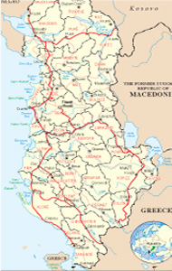
Albanian Map
Links
 |
Publications
.jpg)

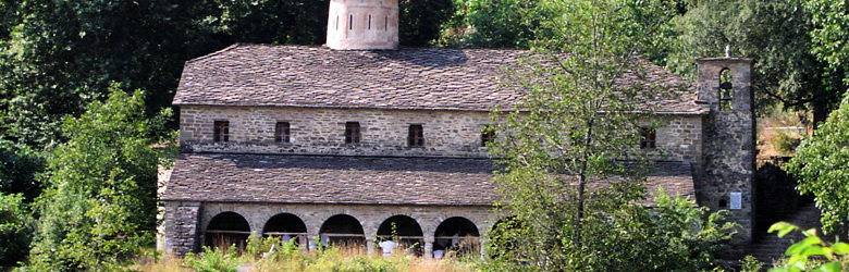
Tropoja General Info
Tropoja is also mentioned as the Highland of Gjakova. Situated at the northern-east side of the country, it has a boundary perimeter of 34 km, and is surrounded by Hasi at the south-east, by Puka at the south, and by Shkodra at the west. The most two important composing parts are The Hole of Tropoja and the East-side Alps.
The Hole of Tropoja has a surface of 254 km2, longitude 10 km and latitude 8 km. It is the biggest one in the Albanian territory, formed because of the neotectonic movements. The constitution of it, is connected with the tectonic Shkodër-Pejë. It composes a hole created 150-200 thousand years ago, which has been a lake for a long time. This justifies the presence of the carbon in this zone. This geographical area includes even the inhabited territory where is situated the main part of the population of Tropoja.
The Hole of Tropoja is situated from 260 m until 700-800 m above the sea level. Three big plains are connected in an arched way and these are the plain of Tropoja, Lluagaj-Luzha and Bytyçi (this composition has also given the origin of the name Tropoja-three fields). The most expressed dunes of these plains are Dobr¬ej (1280 m)-The Peak of Dhina (1270m). Those have conditioned the gradual descent along the lake of Fierza. The most important morphologic elements of this region, are the holes, the valleys and the dunes.
The East-side Alps, are situated at the northern side of the Hole of Tropoja and are part of the Gjakova Highland. Those are composed from calcareous formations which lie at the central part and schistose lands at the northern side. The East-side Alps are situated at the east of Shala Valley and the Groove of Runica. Those have an extension of 40 km from north-south direction and 30 km of extension from east-west direction. The most extended parts are the magmatic rocks. The most predominant structures are the rocky massive blocs as Kollata, Jezerca, The Peak of Hekurave, The open Holes (Grykat e Hapura), Kakia, etc, while the scaled massices are situated at the boundary between the tectonic area of Gashi, Çeremi and Bradoshnica. Among the rugous structures we can mention Shkëlzën-Radesh. The highness of these mountains at the most part is over the 2200 m above the sea level and those have a very expressed alpine relief. The ridges and the river valleys have a general direction, except Valbona valley which has a mixed direction between north-west and south-east.
All this diversity and beauty among mountainous peaks, valleys, surrounded by high rocks, ends with alpine meadows. The Peak of Gusani 2451 m, the Peak of Korritave, are situated at the left side of the valley while at the right side is situated the Peak of Bajraku, between Markofca, Trokuzi and Rupave 2268 m, which are totally covered by the green meadows, differently by calcareous peaks of Shkëlzeni and Kollata which are totally uncovered. The balcony of Shkëlzeni and the balcony of Jezerca are as similar as different from each-other. At these mountains are placed glacial holes or corners which keep everlasting snow.
The glacial circuses are placed at the most part of the ridges and are hanged in gradual way on the holes and the valleys which surround them, over than 1500-1600 m above the sea level. Today a big part of these circuses are occupied from the lakes of Jezerca, Dobërdoli, Sylbica, Mojani, etc.
The climate
The east-side Alps are distinguished from the West Alps by a dry cold climate. This characteristic is reflected very well even in the way of running of the rivers, a big part of which are carstic-alpine types.
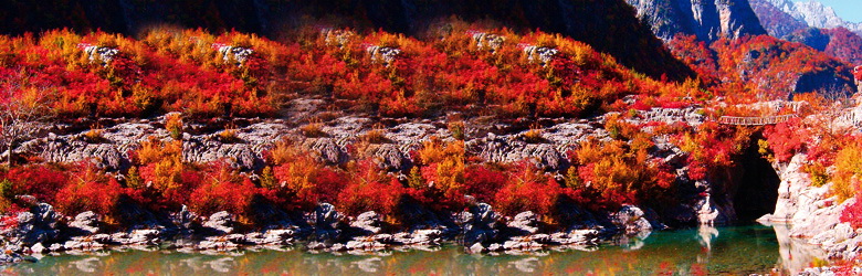
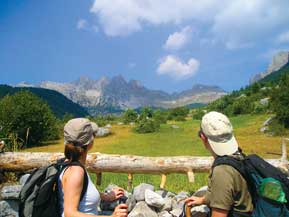
National Park “The valley of Valbona”
It has a surface of about 8.000 hectares and is situated 25-30 km in northwest of the city of Bajram Curri. It expands among high mountains and shows off a fantastic complexion ofcolors in every season, thus giving the image ofa valley full oflabyrinths and surprises. Its scientific, tourist and health recovering values are combined with a bio-diversity of national and international importance. Its rocky and attractive peaks, the sides covered with wood, the flow ofbrooks and river Valbona, viewed from above, create the image ofa giant and marvelous crater as a small panoramaofnatural beauty. . In the inner part of the Park there are a lot of grottos and caves. The most eminent is the Cave of Dragobia, where lay the remains of Bajram Curri, a national hero.
Climatic conditions
Clime, with cold winter and fresh summer with mountainous phenomenon, is favorable for tourists.
You can breath fresh our coming dawn from the mountains. Utilization of sun rises richened with ultraviolet, especially at 09.00, are very healthy. nnual rainfall are 2700-3000m. They are spread among seasons: in spring 22%,insummer 8.7%,in autumn 32.3% and in winter 38% . Rainfall appear like snow that create a sustainable layer for some months.
Flora and fauna
Park with high biodiversity values. It has forests of beech, pine, fir, alpine pastures chestnut forests (Castanea sativa) in natural conditions mountain streams and rivers etc. Low in endemic and sub endemic plants. We meat big mammals as brown bear (Ursus arctos), wolf (Canis lupus), bobcat (Felis lynx), mountain-goat (Ru picapra rupicapra), roe (Capreolus capreolus), eagle (Aquila chrysaetos), etc. in the waters of Valbona we meat Lutra lutra.
Sport and activities
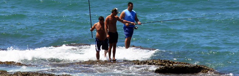
The nature of this park is full of varieties suitable for tourism, fishing, relaxation, amusing and mountain climbing as well as winter sports Mostly you can walk among the wonderful nature, make excursions and exercise different sports as hunting (during the season), climbing, trekking, riding horses etc. The camping is another pleasure but you have to be informed about the right places. Valbona is one of the most beautiful places in Albania and the segments of the Valbona river can be a real challenge for the impassioned of the extreme sports.
What to visit around
The Cave of Haxhia. (Shpella e Haxhisë). Situated on Maja e Thatë, near of Valbona village, at Margegaj, 1630 m on the sea level. It is formed from the carsti along the crossing of tectonic variations. It is discovered so far the entrance 2-3 m and the length about 120 m. Can be visited by the street Bajram Curri- Valbonë.
The Cave of the Ice (Shpella e Akullit.). Situated near of Valbona village, at Margegaj, 2230 m on the sea level. It is formed from the glacial-carstic processes along the crossing of tectonic variations. The explored length is about 250 m. Is 50 m wide and 10-15 m high. Can be visited by the street Bajram Curri-Valbonë.
The Cave of Dragobia (Shpella e Dragobisë). Situated near of Dragobia village, is known also like the Cave of Bajram Curri, a national hero, because he hide there during his war with his enemies. 1200 m on the sea level. It has carstic forme, 8 m long, 3-4 wide and 2-4 high. Can be visited by the street Bajram Curri-Dragobi.
The hanging glacial valley of Kukaj. Situated near of Rragami village, at Margegaj, 1200 m on the sea level. It is a hanging glacial-carstic valley during the tectonic process. 2.7 km long, 100-150 m wide. Can be visited by the street Bajram Curri-Valbonë-Motinë.
The hanging glacial valley of Motina. Situated among the mountain of Irons and the Open outfall (Grykët e Hapura), at Margegaj, 1100 m on the sea level. It is a hanging glacial-carstic valley during the tectonic process. 2.5 km long, 100-150 m wide. Can be visited by the street Bajram Curri-Valbonë-Motinë.
The canyon of Shoshani. Situated near of Shoshanit bridge, at Valbona valley, 400 m on the sea level. Formed from calcareous, the river’s erosion and the carst, is 1.1 km long, 30-40 m deep, and 2,5 m wide. Can be visited by the street Bajram Curri-Shoshan.
The Valley of Gashi
Is situated at the district of Kukësi, at the town of Tropoja. Border line area, with high values of diversity in plants and animals. We meet pine and beech trees, fir forests, alpine weadows mountain small rivers, glacial lakes etc. it is rich in endemic sub endemic plants. We meet also big mammals as Ursus arctos, Canis lupus, Felis lynx, Rupicapra rupicapra, Capreolus capreolus, Sus scrofa, while like birds we meet Tatrao urogallus dhe Aquila chrysaetos. At the fresh and clean waters of the river of Gashi we meet Lutra lutra. The area is very important for the wonderful views. Actual surface is 3000 hectares.