

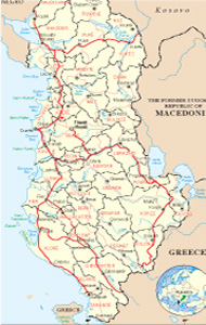
Albanian Map
Links
 |
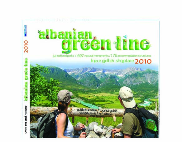
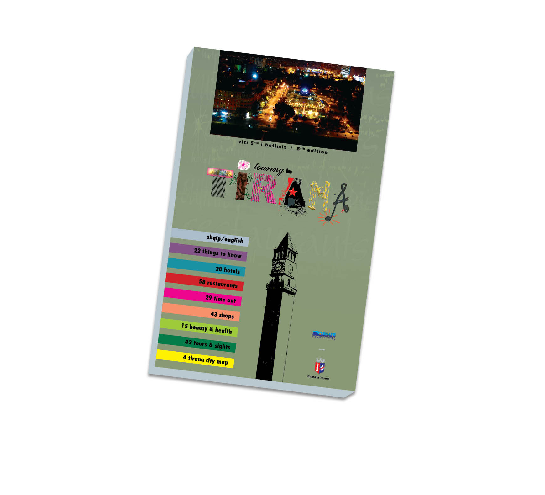
Publications
.jpg)

Malesia e Madhe General Info
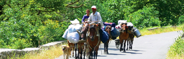
Koplik's northernmost city of Albania. Borders Montenegro to the customs point Hani Hotit and is the capital of the Great Highland district. It is built on two sides of the road Shkoder-Hani i Hoti. The city has great development, especially after 90s of last century. As inhabited area is known from the beginning of our era. In XV-th century was mentioned by name Kopenik. As the center of the district, public institutions are placed in the town, the high school, the museum, cultural house, service shops, etc. ..
History
The archaeological ruins show that this region has been inhabited since the first millennium, when it was formed by Illyrian tribes. During the Illyrian period, the territory was populated by the tribe of Labeats and that of Adrians. The Labeats lived around Lake of Shkodra, which in this period bore their name. Adrians became known in the III-d century, when they moved to the top of the Illyrian state. In XIV-th century, with the creation of the Balshaj dinasty, the Highlanders played a key role in this principality. According to historical documents of the time they were "guard" of the army of the political and military formation.
During the Ottoman conquest, the Great Highland has been the sole province of the Ottoman Empire, to whom was recognize the right of self-government. However this did not prevent residents whenever it was on the brink the national issue, they were at the forefront of the struggle for the protection of Albanian territories.
It is undeniable the contribution of northerners in the Albanian League of Prizren. Among prominent impressive figures, Cun Mula, lider of Hoti,. He led the assembly in this irreversible decision northerners, who declared to die, in front of giving up decision.
Cultural life
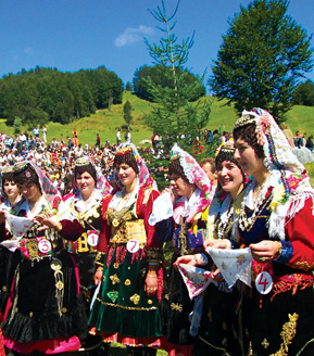
The area of the Great Highland as a center of early inhabited, has maintained its inherited culture generations, in accordance with its historical, economic and natural traditions. In material culture it has the characteristic clothe for women, called “xhubleta”, meanwhile the spiritual culture pf this region is the speech.
“Xhubleta” represents one of the most interesting costumes of women in all the Balkan Area and beyond, on the shores of the Mediterranean. For many of foreign researchers, as the Nopcsa or Albanians as A. George, Rr. Zojzi etc., the origins of “Xhubleta” comes from the civilization we see in Kreta and Mikena. So it is a witness of the ancient Mediterranean civilization, which preceded the Illyrian civilization, in which, was integrated and was not assimilated. Xhubleta makes double life, living life, as used today and museum life. Xhubleta, as part of the suit of the region, is stored in several museums of Europe. We can distinguish the famous museum's Man in Paris, which belongs to the XVIII-th century. The Hungarian author, Kornidez Daiel, said: "No peacock or rainbow do not have colors as much as “xhubleta of Kelmendi” has. It encompasses a variety of geometric motives, cosmetics, floral, zoological, anthropomorphic etc. prevails among them a particular fund, ornaments from ancient pagan cults.
Log of the Mountains
“Miss Mountains”
The organization of this activity originates from ancient times, from the passion of the highlanders for the beauty. In the centuries, they have sung the beauty of their country, but also the beauty of girls, brides, women. This tradition has been declared celebration day in 1998. It was decided in August to develop in the meadows of Lëpusha the competition of the magnificent mountain girls of this area. Girls in their debut would hold the traditional highland dress, xhubleta. From this competition was selected the most beautiful girl, which is known as "Miss Mountain". Today in this annual activity increasingly participate personalities of culture, art, politics from the country and also by Albanian personalities abroad.
Folklore
Customs, habits, songs, waves, dresses and various skills of this province has distinguished and artistic value. There are researchers, that call the Great Highland as a territory with ancient culture, the place, where were born two major EPOS, two poetic "wills" "The Epos of heroes”, gathered by Bernard Palaj and Donat Kurti and "Epos of Fishta" the Albanian Homer, "Highland’s Lahuta”.
Dances
The Traditions of the Highland which including the dance, constitute in one of the most authentic cultural layers of ancient Albanian culture. The popular dance in this region is quite rich. It consists of military epic of courage dance, erotic, wedding dance, etc. "Dance of the Sword" in Albanian choreographic poetry forms what is called "combat dance". The dance is practiced at the close of the log, creating the situation in height, solemn. Great Highland culture for its artistic value is quite famous in all national folk festivals organized in Albania. Performances are honored with various premiums.
Songs
The “Lahute”, has been the only musical instrument that followed the epic ions through the lagoons and the slopes of Highland. It is the "Phonetics" that has preserved forever the "Epos of the Heroes”. This musical instrument came later, it was the famous artist Sali Mani to make it popular and used in large area.
The Characteristics houses
The house was that of type “tower”. In most cases, was built two-storey stone walls of lime. The first floor is used for housing livestock and was called "stable". It had a height not greater than two meters and was divided into two rooms. On the second floor it was lived the entire social life of the family. Here was the striking men's room or known as "chambers of men". It was part of the house maintained and used only to welcome guests. Highland House of men has become a myth, because in this area get enough decisions of community, but was given for the fate of our country. On the second floor was women's rooms and kitchens where family meals were prepared
Cultural monuments
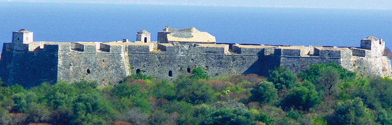
The Castle of Ballexa in the village of Rrjoll. According to archaeological studies belongs to the medieval period, the time when Albanians were called Arber.
The Castle of Marshejit in the village Marshej. Even today preserved in good condition and presents the archaeological and tourist values. This castle belongs to the first period of Iron.
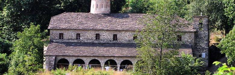
Church of St. John (Shninit) in Hysaj village: it is one of the oldest Catholic churches that attests to the early Christian culture in our area.
Tamara Bridge in the village of Tamara: it is an arch bridge with architectural values.
The Bridge of Dry Stream
Vukplaj Bridge.
Industry and Craftsmanship
The Great Highland was and is already famous to the arts of building work tools. The famous Albanian lover Edit Durham in her work "Concerns of Balkans" pays particular attention to this tradition. Highlanders are called calls "masters" from her. For costumes, she says that they "were made to add majesty and grace of the area residents. " In her descriptions xhubleta showy mountain women with its decorative ornaments. Occupy a special place çakçirët doublet of the mountaineer. They are designed with a style of the artist and distinguished by their grace and aesthetic high. This tradition has been prevalent in Kelmend, Shkrel, Kastrat etc.
The natural monuments
Geo-monuments
Kelmendi’s fortress. Located near the village of Nikç, Kelmend, 550 m above sea level. represents a limestone natural castle, formed by wind and carst, about 20 m width, height 15-18 m, the surface a few hundred m2. The rural road-Tamara-Nikç Koplik.
Stacks of stone in Bajzë, found near the village. There are some limestone blocks on each other, in shape of stack, mullari, height 4-5 m, 2-4 m wide, formed by wind and carst. Koplik-Bajzë-Hani i Hotit.
The Castle of “Path of the sheeps” (Shtegu i Dhenve). Situated near the village of Bogë, 2050 m above sea level. There are some limestone blocks with pyramidal shape, created from the wind and carst, 150-200 long, 130-150 m high, 80-100 m wide. The rural road-Theth Koplik.
Union’s canyon. Located near the village of Vermosh, commune of Kelmend, 900-950 m above sea level. Canyon was formed from limestone by the river of Vermosh and carst, 1.1 km long, 30-40 m depth, 4-6 m wide. The rural road Koplik-Tamara-Vermosh
.
Poica’s Canyon. Situated 250 m above sea level, near the village of Zagora. Recognized also as the Dry Stream’s Canyon. It is formed by erosion of the stream, 2.2 km long, 20-30 m high, with holes, caves and carstic caves, 30-40 m of depth, 4-6 m wide. The rural road Koplik-Zagora.
The terrace of Gërçe. Situated in the village of Selce, Kelmendi commune, 600 m above sea level. It is a rocky terrace, formed between two limestone crags, 120 long, 100-110 m wide. In 1911 and in this terrace, was signed by Albanian leaders Gërçe’s Memorandum, which required administrative and territorial autonomy of Albania. The rural road Tamara-Selce.
The Stone Stacks of Radi in Rrapsh. Situated near of the village, 740 m above sea level. Limestone rocks represent a stack shape, created by carst and wind, 2-3 m long, 4-6 m wide. It has geo-morphological values, as didactic and tourist as well. The rural road Rrapsh-Koplik.
The Glacial moraines in Razma. Situated in the village of Razma and Vruth, commune of Shkrel, 1050 m above sea level. There are deposits of glacial quaternaries coming from the excavated area of Karikjeve cirques. Those create hills 50-80 m high, 1.7 km long, 1.2 km wide, filled with funnels and holes. The rural road-Dedaj-Razma Koplik
Fluvial-glacial deposits of Boga, near Ducaj village, commune of Shkrel, 830 m above sea level. There are deposits of waters and glacial of Boga valley. They have the form of barriers 5-7 m high, 800 m long, 18 m wide. The rural road Bogë-Koplik.
The glacial cirque of Boga Valley. Situated in Bjeshket e Namuna, 1820 m above sea level, commune of Kelmend. It is 800 m long, 250-300 m wide with carst forms. The rural road Bogë-pedestrian street.
The glacial groove of Runica. Located between Bjeshket e Namuna and Jezerce, 1200 m above sea level, near the village of Theth commune of Shala. Created as a groove of glacial-carst limestone, along the tectonic separation, it has the shape of trough, 1.8 km long, 500-600 wide. Surrounded by beech forests. The rural road Theth Koplik.
The glacial groove of Seferça. Situated on the northern edge of Albania, Vermoshi village, in the commune Kelmend, 1870 m above sea level. The groove has the shape of trough, over 1800-2000 m long, 300-400 m wide, Surrounded by beech forests. The rural road Tamara-Vermosh-pedestrian street.
The cave of Krevenica. Situated near the village Kushe on the road Bajzë-Hani Hoti, 10 m above sea level. It is a carst cave formed at the junction of tectonic break in the Trias-jurasit limestone about 20 m long, 10-12 wide, 4-5 m high Inside are situated three lakes, where residents take water with pumps. Can be visited by the rural road Koplik-Hani Hotit.
Puci’s cave. Located near the village of Boga, Dedaj commune, the northern slope of the mountain of Çardaku, 1087 m above sea level. Carst caves explored by speleological groups of San Marino and Brescia, also by F. Krutaj, but not explored completely. It came out from an underground lake, which is perhaps, one side of the siphon that issue in other areas of the cave. It is over 5 km, the largest so far in Albania. Consists of several floors, wells gallery, shrinking, expansion of large halls with calcareous concretions rare for their beauty. It relates to the Cave of Husi, with a horizontal gallery 275 meters long and descends to -355 m depth. The rural road-Bogë-Theth Koplik.
The Cave of Wet People. Located in the village of Boga, commune of Dedaj in Mount of Çardaku, 2050 m above sea level. Explored only to 2 km length speleologist of San Marino, and F. Krutaj. Established by carst in limestone, there are wells that go down to 347 m of depth and combined with the narrowing of the concretions and rooms of a rare beauty. The rural road Koplik-Bogë-Theth-way to the caves.
The well of Xhek Marku. Situated in the village of Bogë, Dedaj commune, in the tableland of Bridashës, 1800 m above sea level. It has taken the name of a citizen who fell down into the well 80 years ago. The bones appeared speleologët of San Marino, constitutes karst shaft, -234 m deep. Entry 5 m diameter, up to 15 m depth, where the show du wells that go down to 104 m. These emanate main well of -130 m deep. There are some adverse ramifications, still uncharted, plow, snow and ice fossil, probably Quaternary. The road-Bogë-the street to Bridashë.
17. The Cilikojka well. Located near the village, commune of Dedaj, 1840 m above sea level. The name was taken from birds introduced there. The well constitutes in glacial-karst limestone of the Trias-jurasi, with the entrance with few meters of width, with shrinking and expansions, concretions, fossil rocks, probably Quaternary. Bogë-Bridashë.
18. Gjolaj cave. Situated in the village of Bratosh. Glacial-karst cave, formed at the junction of tectonic break in the Trias-jurasi lime. It begins with karst and is over 116 m long, 20-25 m wide, 25-27 m high. There is a very large room with stalactites, stalagmites, columns quite beautiful. The road to the cave-Bratosh-Gjolaj.
4. Hydro-monuments
19. Eye of Shegani, Aliaj. located near the village, commune of Bajzë, near Shkodra Lake, about 6 m above sea level. Recognized and named " Sifoni i Virit”. It is a great source of vauclusian karst in tektonic-karst cracks, emanating from a chimney karst landscape with depth 3-5 m wide 22-28. It refers to two sources. The water comes from karst areas od the Western Alps of Albania. It is rich in fish species and other species. The sources create attractive environment. The rural road-Ivanaj-Shegan Koplik.
Koprishti source. Selce, Kelmend, 1450 m above sea level. It comes in source karst limestone-flysch contact, from a 3-5 hole wide, with 3-5 deep, which emanate the river of Selca. Tamara-Gropat e Selcës.
John's eye. Near the village of Gruda, Gruemirë commune. Emerges as a source of karst in limestone-molasë quaternary, in contact with the surface of 60-65 m2. Large inflows, which are used to supply the population. Shkodër-Vrakë rural road- Fushë Grudë.
Vukli resources. Vukël, Kelmend, 500-550 m above the sea level. There are several sources of karst, limestone-terrigenous in contact with the flux of 800 l / sec that feed the river of Cemi. The rural road-Tamara-Vukël Koplik.
Bio-monuments
The lime-tree of Bzheta.
The oak-trees of Markaj well.
The Beech-tree of Greçe.
The trees of Vrithit in Razma.
The grove of Pleshti (hopper) in Bogë.
Vulfenia of the path pf the Sheeps
The Big Nut-tree in Zagora
The leaf-forest of Lohja.
The plane-tree of Ganjolli.
The chestnut-tree of Reçi