
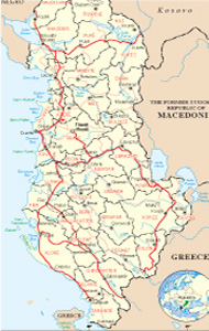
Albanian Map
Links
 |
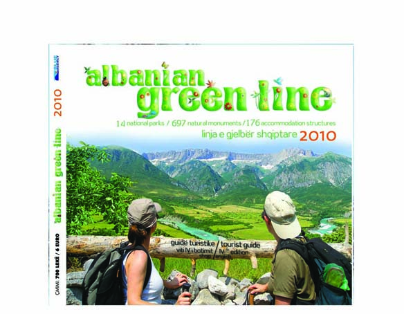
Publications
.jpg)

Kolonja General Info
Kolonja lies at the Central South Highland, at the southern part of it. The area of Kolonja is rich in natural resources with considerable tourist potentials. Mention can be made of the natural riches of Germenj-Shelegur, the thermal zone of Vormoner and the sulphuric gases of Postenan. The area is mainly agricultural and stock raising. Among gricultural plants mention can be made of wheat, vegetables and fruit tress (apples, plumbs, nuts, cherries,
vines, etc.,) The area is famous for the tomatoes of Sanjolas, the cherries of Poda, the grapes, vines and raki of Leskoviku. The area of Kolonja, spreading over 80 thousand ha, is part of the Region of Korca. It possesses forest area at the size of 35 thousand ha, pasture area at 22 thousand ha, a game hunting area at 40 thousand ha available for hunting and an additional area of wild animals and birds measuring 26 ha where hunting is prohibited.
The town of Erseka is the capital of the region, part of Korça county. It is situated in the southeastern part of Albania
Geographical position
It borders on the North on the greater Korca area, on the West and Southwest on the greater area of Përmet and on the southeast on Greece. The border with Greece is mainly made up of the mountain of Gramoz with the highest peak of Cuka e Pecit at 2523 meters above the sea level. Within these natural borders, Kolonja measures an area of 805 km2. It has the highest altitude in Albania with an average of 1.100 m above sea level. The area of Kolonja is highly fragmented and is transversed by the River of Osum, several branches of the River of Vjosa (Langarica and Sandrapori) and a number of torrents which come down from the mountain of Gramoz. At certain points along their lengths they create very deep segments. This is one of the reasons why cold waters are very deep.
Climate
The area of Kolonja is part of the climatic zone characterized as mountainous Mediterranean. It has typical cold winters (median temperature in January is between 0-6 0C) and cool summers (median temperature in July is 19, 4 0C). Rainfall is limited (800-1.000 mm a year) The variation of altitudes generates microclimates which vary in accordance with position and relieves representing in all cases habitats of the rich flora and fauna.
Flora and fauna
The region has a rich flora and fauna. About 45 per cent of the area is covered with forests and shrub vegetation. More common are the woods made up of pine, oak and other tall trees. Alpine pastures are also very common in the area. It is a true harbor of flora and fauna given the vertical spread of the area from the low zone of Sandrapor-Leskovik, at 460 m above the sea level, up to the alpine pastures at 2.523 m altitude above sea level (the mount of Cuka e Pecit).
An important part in relation to the range of fauna in the area of Kolonja is the Eastern border above the inhabited part up to the border with Greece, the Mountain of Gramoz which is home to all kinds of fauna typical for mountainous areas of which mention can be made of the wild rabbit, the fox, the bear, wild goat, wild pig, etc. The area is also full of birds of all kinds such as the eagle, the wild cock, the wild dove, the owl, ringdove, turtle, woodpecker, blackbird, nightingale, craw, badger, shrew, sparrow, partridge, raven, redbreast, jackdaw, falcon, etc. Of the mammals mention can be made of the wild rabbit, the insect eaters such as mice frog, etc.) the brown bear, the fox, the wolf, the wild cat, the wild pig, wild goat, deer, etc. For all of the kinds of birds and animals populating the area, there are accurate inventories in terms of numbers and habitats.
Water resources
The area has a broken relief of deep cold waters, rapid mountain streaks and capture areas protected by nature itself up in the height to the mountains. It is rich in both ground and underground water sources such as the source of Kozeli, Imavra, Vllkaka, Laca, Vodica, etc. The water at the sources is clean and cold. However, on the way from the high mountain peaks to the habitats, there are many pollution risks. There are a number of villages situated at the foot of the Mountain of Gramoz which are home to water sources supplying the greater number of the population in the area. If urgent measures are not taken to protect the water sources, the situation may be threatening to the population’s health. Due to pollution a number of sources and wells are now used only for watering.
Possibilities for tourism and leisure
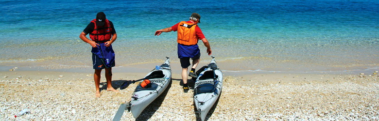
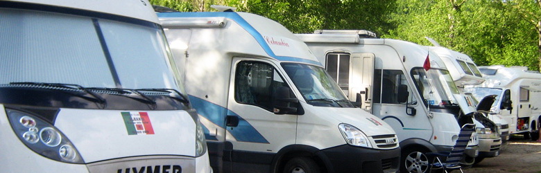
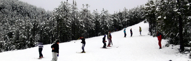
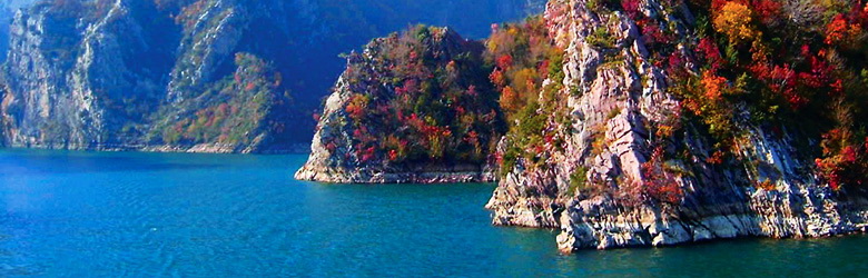
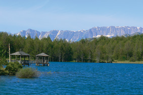
Situated at the foot of the mountain of Gramoz, the area of Kolonja is highly likeable for the cool and clean air throughout the year. It is famous especially for its snow white winters. The National Park of Germenj about 30 minutes away south of Erseka, represents a protected forest area of 7,300 ha home to a variety of wild fauna. The area has a breathtaking landscape which makes Kolonja a very attractive place for alpine tourism and outdoor activities and sports. The Lake of Sheleger is another natural asset which deserves to be visited. In the summer time, camps and other facilities are created to provide accommodation for visitors and tourists in the area. Another of the wonders in the area lies east of the town of Erseka, i.e., the village of Rehova which represents a small traditional settlement still unexplored and virgin. The village has homes made of stone and roads paved with mountain tiles. The hotels built and rehabilitated recently in Erseka and Gërmenj are fully equipped to receive visitors and tourists all round the year.
The natural monuments
Geo-monuments
Postenan steam bathrooms. 1400 m above the sea level. Represent hot steam of mining explosions. Their appearance on the surface to about 30 m2 is connected with the tectonic break. It contains sulphurous. The residents use it in the treatment of diseases. Leskovik-Postenan itinerary.
The canyon of Virka. Gostivisht, 1000 m above the sea level. 1 km long, 2-4 m wide and 80 m deep Constitutes in epygenic transverse gorge, formed by erosion of the stream of Virka and karst. The Slopes have karst caves. It creates a karst ecosystem. Ersekë-Gostivisht itinerary.
The cave of Poda. Leskovik. It is still unexplored, formed by karst in the limestones of Crete, with entrance of 4 m long and 3 m wide, it has rooms with stalactites and stalagmites. Ersekë-Podë itinerary.
The earth-dunes of Piskali. Represent flysh landscape, hundreds of hectares highly degraded and deserted as a result of bigr erosion, conditioned by natural factors and from using of the vegetation. Ersekë-Piskal itinerary.
The tectonic window of Qinam-Vodica, Mollas Constitutes in an interesting geological phenomenon: inside of the surface tectonic Mirdita appears the paleogenical flysch of Krasta. Has seen studied by V. Melo. Ersekë-Qinam itinerary.
The travertines of Blushi. Qendër. Constitutes in a massive of travertine with gallery 3-4 m long, width and height of 80-100 cm, established on the outskirts of karst resources, whose waters contain large quantities of calcium carbonate. The recipitation of this mineral content is made in conditions of dense vegetation. Ersekë-Blush itinerary.
The well of Llokafi Gostivisht. 920 m above the sea level. It is a karst well, still unexplored. The known part of the entrance is 1 to 1.5 m wide, 20-22 m deep. Ersekë- Gostivisht-St.Mërtir itinerary.
Hydro-monuments
Rehova’s waterfalls. Qendër. There are several waterfalls, the largest 23-25 high, while the width of the flow is 2-4 m. The water is used for electricity power production in Rehova. Ersekë-Rehovë itinerary.
The glacial lake of Gramozi. 2400 m on the sea level, 0,4 ha, is located in the glacial cirques of Gramozi mountain, surrounded by dense grass vegetation. Ersekë-Starje-Gramozi Lake.
The Thermal sources of Vronomeri. Kuqesh, Leskovik in the valley of Sarandaporosit, Vjosa’s branch, 430 m above sea level. There are several thermal springs that emerge at the foot of the rock, with 40-500 degree C and sulphurous content. Leskovik-Kuqesh itinerary.
Bio-monuments
The trees of Golos in Gërmenj.
The Oak-tree of Saint Mary in Gostivisht.
The Oak-tree of St. Nicholas in Lëngëz.
The multitude of wild Poplar in Varishtë.
The Elm-tree of Badra, Taç.
The Plane-tree of Leskovik.
The Laurel-tree of Cercka.
The Grove of St. Thanasi’s mill.
The Plane-tree of Mbreshtani.
The Pine-tree of Pogonica in Radanj.
The Plane-trees of Glina.
The Fir-tree of Shticka
The cypress-trees of Radova.
The grove of St. Nicholas in Vodica.
.