
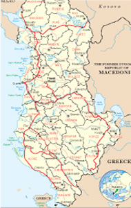
Albanian Map
Links
 |
Publications
.jpg)

Puka General Info
.jpg)
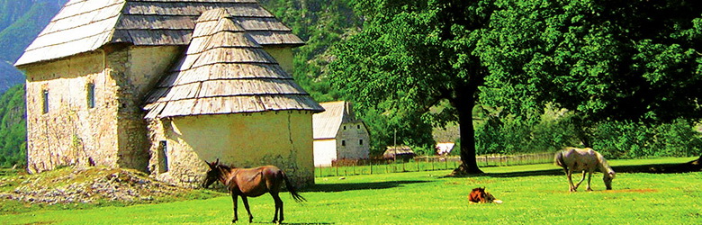
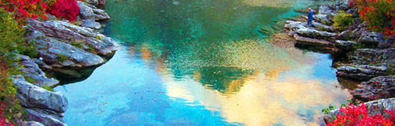
Puka town is part of Shkodra district, very attractive place, with a green crown, mountains, forests, and caves where you can follow in adventure. Inside of it, there are at list 17 monuments of nature. Other dwellings in this area: Fierza, Iballa, Qelezi, Gjegjani, Fushë-Arrëzi, Blerimi, Qafë-Mali, Rrapa etj. In these zones lives a very vital population, diffused everywhere in the territory, enriched with an old history, documented from the archaeological centers around, from the vestiges, castles, Illyrian walls, from the spiritual inheritance expressed in the songs and dances according to the traditional folk of the zone.
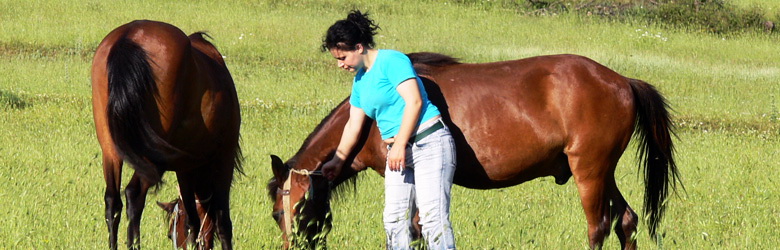
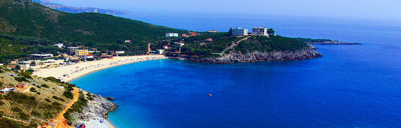
This mosaic of the natural environment and human one composes a powerful source of tourism, in different fields as walking, ski, alpinism, hunting sports, (wild animals and fishing), and also for other recreative activities for relax and entertainment.
All this activity can be a potential for the economical development of the zone.
Relief and climate
The district of Puka lies at the central part of the Northern Albania, on the right side of Shkodra, in a rough and variety of relief which includes mountains, deep valleys, rich forests, green meadows, greenswards, percolated from numerous streams and rivers, with crystal waters, fed by the snow, which lives until the early spring. In the north and the northeast Puka is surrounded by Has district and Tropoja, in the south, with Mirdita district, in the southwest with the district of Lezha and in the west with Shkodra.
The climate is cold, with long and snowy winter and short fresh summer. The minimum and maximum of degrees goes from -10 grade Celsius (January) until 20-22 grade Celsius (July).
History
Puka emerges for the first time in the documents of the works of Prokop and Caesar, the great historians of the time of Emperor Justinian. The name Puka, according to the opinion of that time, comes from the "Via Publica, road of Puka, the pedestrian street and the caravans that passed here, from antiquity until the Middle Ages, due to its favorable geographic location of Puka. Nopcsa thinks that Ad Pukaria and Puka are the same, due to compliance of geographical coordinates and other data. In the period Pukawas inhabited by the Illyrian tribe of Pirusts, known for mining and processing of metals. During VI-VIII-th centuries, this tradition was included in the "culture of Koman" in Dalmatia and is part of the culture of arbër. During XIII-XV-th centuries in this area was formed the principality of Dukagjinas. Frang Bardhi, archbishop of Zadrima, lexicographer, ethnologists, historian, qualifies Puka as a country with noble habits, high sense of hospitality and especially fans of gratitude to prominent figures as Skenderbeg and Lek Dukagjini, their “god”.
Puka has a crucial role in the League of Prizren, where helped with fighters and personalities as Ismail Kryeziu, Musa Dizdari etc. During World War II and later, Puka became a small mountain town, famous for producing lumber. Puka is rich in minerals such as copper, chrome, asbestos, volcanic glass etc.
Culture and ethnography
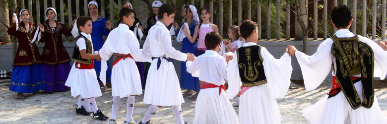
Since the time of Pirusts the residents of Puka region had tradition in building of tools work, how to improve the living condition. Noting the propsperity of the areas of Puka, Frang Bardhi, mentions a precious cross, which is in addition to ethnographic value (such as craft paper), shows the date of his paper, in 1637. Also valuable are the writings of Han, where craft works of Puka, are evaluated, particularly in the felt of white or gray ("tirq", xhoublet, woolen clothes etc.), but also the works of clay, terracote, ceramics etc. From the data of the documents of the period, the craft has been noted for the manufacture of wooden vessels, wooden spoons, ladle, cups, rosettes on ceilings and musical tools as lahuta, Çiftelia, shank etc.. In particular, these are produced in villages of Kabashi, the area of Drini, Gojani etc. being an ancient settlement, the region of Puka, in accordance with its historical, natural, economic traditions, like many other provinces, has maintained its rich culture. Early traditions are found in folklore, which the artist Pretush Gega, has expressed beautifully in his songs with pieces of life from his “çiftelia”, for the northerners of the region. A rich tradition of Puka are the costumes (dress). Distinguished clothes we find in Kabashi, Koman, Mirdita, Iballa and other variants within them..
Sports and activities
The most attractive part is the ski area, where you can see not only the amateurs but even professional championships. Other activities are the mountain climbing, trekking, speleology, camping etc.
Accommodation and gastronomy
The base of the accommodation in this town is Puka Hotel, the old tourist structure, totally reconstructed, which offers to you all the necessary to have a high standard of accommodation an gastronomy. European cuisine and luxurious conditions are at your disposal but you will find also traditional food and environments.
What you can visit
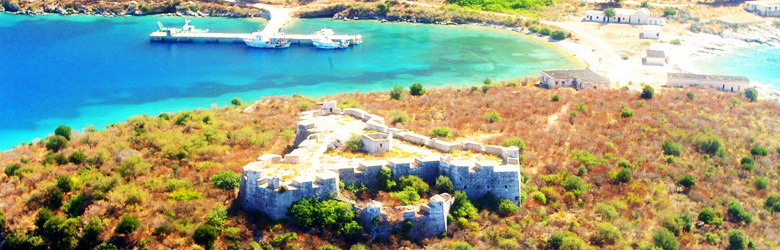
Kauri Cave, situated at village of Lëvrushk, in the mountain of Kollata. 250 m long. The known part is very attractive. Can be visited by the rural road Pukë-Lëvrushk.
The carst of Munella, near of village of Tuç, the contea of Qafë-Mal, at the back side of Munella mountain, 1990 m on the sea level. Can be visited by the rural road Fushë-Arrëz Tuç-Munella mountain
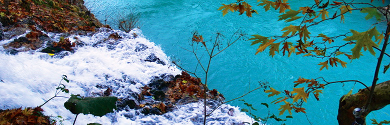
The waterfall of Kryeziu, situated at the village of Kryezi, the contea of Qafë-Mal. It is at the small river of Orosh.can be visited by the road Fushë Arrëz-Kryezi.
The forest of Dardha. It is a mixed forest with beech and pine trees, 450 m on the sea level. Here we can find the Black Pine of Dardh, monument of nature, 100 years old, 25-30 m high, diameter 250 cm and perimeter 750 cm.
Mountain of Munella. Lies on the border Mirdite - Puka between Valley of the Big Fani northwest and lower in the southeast, is rich with various animals which makes more favorable for hunting.
The natural monuments
Geo-monuments
The timescale of Gomsiqe, near of the village, 800 m on the sea level. Is consists in remains of tortonian peneplene; the flatten of the relief from the activity of the natural factors, 17 million years ago, in condition of a total relax of tectonic movements. It has the shape of a hidden tableland, 1,5 km long, 700-750 m large. It has scientific, geo-morphological, geological, didactic and tourist values. Can be visited according to the itinerary Pukë-Gomsiqe.
The Carst of Munella mountain., near of the village of Tuç, Qafë-Mal commune, on the ridge of Munella mountain, 1800-1990 m on the sea level. It represents carstic sight, with holes, hoppers, wells, carstic wells etc. It has scientific, geo-morphological, geological, didactic and tourist values. Can be visited according to the itinerary Fushë-Arrës-Tuç-mali i Munellës.
The cave of Kauri. (Or the Cave of Monks), near of the village of Lëvrushk, at the mountain of Kollata. Created as a carstic cave at the calcareous of trias-juras, 250 m long 3 m large, with numerous concretions, ta. It has scientific, geo-morphological, historical, didactic and tourist values. Can be visited according to the itinerary Pukë-Lëvrushk.
The Saint Stone, near the village of Zezaj, 538 m on the sea level. It is granite stone in polygonal shape, connected with the legend of Scanderbeg, our national hero. It has scientific, geo-morphological, historical, didactic and tourist values. Can be visited according to the itinerary Pukë-Zezaj.
The mahogany of Leka. Situated 350 m on the sea lebel, near of Kabashi village, in the commune of Rrape. It is stone mahogany, 7 m2, and the information about it, is connected with Lek Dukagjini an Albanian patriarch, who use to join there the convents of the zone. It has historical and tourist values. Can be visited according to the itinerary Pukë-Kabash.
The ammonite fossils of “Triasiku i Poshtëm” in Kçira. Situated 600 m on the sea level, in the village of Kçirë. Studied by the Austrian geologist F. Nopça. It has scientific, geo-morphological, historical, didactic and tourist values. Can be visited according to the itinerary Pukë- Kçirë.
Hydro-monuments
The waterfall of Kryeziu, near of the village, the commune of Qafë-Mali. It is placed at Orosho stream on the magmatic rocks. It has two groundsels, 3-4 m of height, and two dams 1 m deep. It has scientific, geo-morphological, hydrologic, didactic and tourist values. Can be visited according to the itinerary Fushë Arrës-Kryezi.
Bio-monuments
The chestnut-tree of Kokdodi. Situated 981 m on the sea level, near of Kokdodë village, commune of Iballë. It is a chestnut forest about 10 hectares, 15-17 m high, diameter of 100-130 cm, age of over 100 years, damaged from natural causes. e dëmtime të vogla nga sëmundje. It has scientific, geo-morphological, biologic, didactic and tourist values. Can be visited according to the itinerary Pukë-Iballë-Kokdodë.
The two Old Trees in the Cemetery of Korthpula. , commune of Luf, 500 m on the sea level. Those are two old oak-trees (a special kind) 15-16 m high, perimeter of the crown about 70-75 m, diameter 1-2 m and age of over 300 years. It has scientific, geo-morphological, biologic, didactic and tourist values. Can be visited according to the itinerary Pukë-Gomsiqe-Korthpulë.
The Oak-trees of Shënkoll Cimitery. Situated near of Kryezi village, commune of Qafë-Mal, next to the church, 600 m on the sea level. Those are 5 trees of a special kind of oak-tree family, 20-25 m high perimeter of the crown 180-200 m, diameter 90-100 m, age of over 250 years.
The Oak-Trees of Mosque. Situated at the cimitery of Kryezi, komuna Qafë-Mal. It has an oval crown, 10-12 m high, perimeter over 350 cm, diameter 130 cm, age of 250 vjet. Ka vlera shkencore biologjike, didaktike, estetike, historike, fetare. It has scientific, geo-morphological, biologic, didactic and tourist values. Can be visited according to the itinerary Fushë-Arrës-Kryezi.
The spring of Ndërlugjeve. Situated 800 m above sea level, near the village of Meçe commune of Rrape. 4 trees of 200 years old, 15-16 m height, crown circumference 1.7 to 2 m, 90-100 cm diameter tree. Biological research has value, didactic, historical, religious. Can be visited according to the itinerary Pukë-Meçe.
The Black Mulberry. Situated 800 m above sea level, near Puka town. It is separate black mulberry, aged 100 years, over 9 m height, tree diameter over 1m. It has biological value, didactic, historical and religious ones. Can be visited where going into the city of Puka.
The pond of Tisit. Situated 650 m above sea level, in Gomsiqe valley near the village Pezhvë municipality Tërbun. It is about 9 m tree height, tree diameter of 80 cm, age 100 years. There are biological scientific values, didactic, tourist ones. Can be visited according to the itinerary Pukë-monument
Dardha pine. Located about 450 m above sea level, in the cimitery of Dardha village, Blerim municipality. Black pine is 20-25 m height, tree diameter over 250 cm, the circumference 750 cm, older than 100 years. It has biological value, didactic, historical and religious ones. Can be visited according to the itinerary Fushë Arrës-Dardhë.
The acacia-trees Migjeni. located in the town of Puka, near of Migjeni’s Museum. There are some acacia, under the shadow of which the great poet Migjeni use to relax. There have historical, and cultural values.
The pine-tree of Shejza. Situated near the village of Puka, Iballë. The single tree is located between the bushes, is higher than 20 m, diameter of the tree about 50 cm over the 1.5 m circumference, age over than 200 years. It has scientific, biologic, didactic and tourist values. Can be visited according to the itinerary Fushë-Arrës-Iballë.